About Us
Kabondo Kasipul Constituency
1. A detailed description of theconstituency
Kabondo Kasipul Constituency was one of the constituencies created in 2013 by the Independent Electoral and boundaries Commission (IEBC). The constituency has four wards namely Kabondo West, Kabondo East, Kojwach and Kokwanyo Kakelo.
Vision;To be a constituency where Communities are exploiting Development Opportunities and Sharing Prosperity
Mission;To develop and improve sustainable livelihoods of constituents in partnership with stakeholders
Location and Size of the Constituency; It lies within longitudes 34.85 North, 0.44 degrees East and latitudes 0° 20’ South and 0° 50’ South. It is bordered by seven (7) constituencies namely; Sigowet/Soin to the East, North Mugirango and West Mugirango to the South East, KitutuChache North to the South, Kasipul to the West, Karachuonyo to North West, and Nyakach to the North. The Constituency covers a total area of 249.80 km2.
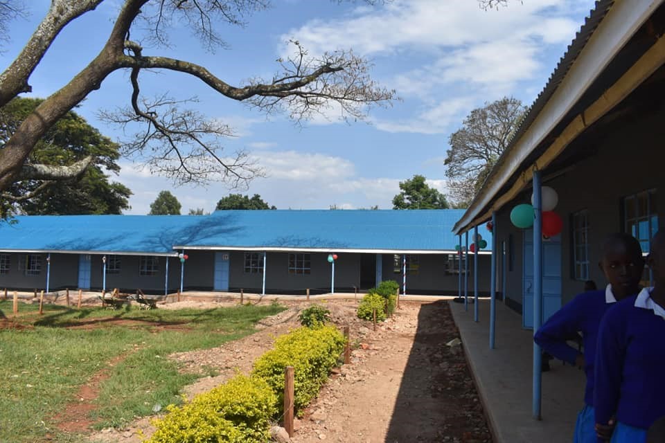
Administrative Units; Kabondo Kasipul Constituency is the electoral constituency number 246 of the Republic of Kenya. It is one of the eight (8) sub-counties that make up Homa Bay County. Kabondo Kasipul is made up of four wards which form the political representation units, namely: Kokwanyo-Kakelo, Kojwach, Kabondo East, and Kabondo West. The constituency is administratively in Rachuonyo East Sub-County that is made up of two Divisions of Kabondo and East Kasipul. It consists of 11 locations and 23 sub-locations.
Physical, Topographic and Ecological Features;the constituency is divided into two main relief regions namely the lowlands towards the Lake Victoria basin and the highlands bordering Kisii and Nyamira Counties. The constituency lies between 1,160 -1,220 m above sea level. It is characterized by hills including; Gangre, Nyabondo, Olak, Ongoro, Dudi, Kimori, Adega, Rateng, Oogo, Kimondi, Okombo, Komala and Atela. It has a number of rivers which originate mainly from Kisii and Nyamira highlands namely; Miriu, Nyamwaga, Awach Pala, AwachOthoro, Anyona, AwachKadongo, Opilu, AwachOgera and Orue. Kabondo Kasipul has 2 waterfalls namely; Odino and Atemo Falls.
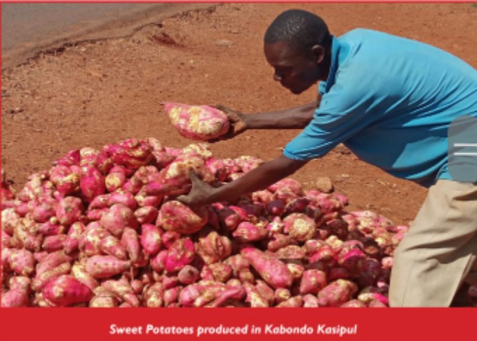
The main Wetlands in the constituency include; Nyamwaga, Luanda, PundoLando and Tala. The constituency has the following gazetted forests; Kasewe, Kamondi, Kawuor and Anuoyo in Kakang’utu west. It also has dams which include; Kokise in Kodhoch, Kagero in Ramula, and Anuoyo in Kakang’utu west. The constituency also has a man-made lake called Odino-Nyandolo. It is characterized by a range of mineral-rich soils, predominantly of red-clay to loamy types thus making it suitable for variety of agricultural activities.
Access NG-CDF Information on your Mobile


County Assembly Wards in Kabondo Kasipul Constituency:
Kabondo West Ward
- County Assembly Ward No.:
- County Assembly Ward Name: Kabondo West
- County Assembly Ward Population (Approx.):
- County Assembly Ward Area In Sq. Km (Approx.):
- County Assembly Ward Description: comprises part of
Kabondo East Ward
- County Assembly Ward No.:
- County Assembly Ward Name: Kabondo East
- County Assembly Ward Population (Approx.):
- County Assembly Ward Area In Sq. Km (Approx.):
- County Assembly Ward Description: comprises part of
Kojwach Ward
- County Assembly Ward No.:
- County Assembly Ward Name: Kojwach
- County Assembly Ward Population (Approx.):
- County Assembly Ward Area In Sq. Km (Approx.):
- County Assembly Ward Description: comprises part of
Kokwanyo Kakelo Ward
- County Assembly Ward No.:
- County Assembly Ward Name: Kokwanyo Kakelo
- County Assembly Ward Population (Approx.):
- County Assembly Ward Area In Sq. Km (Approx.):
- County Assembly Ward Description: comprises part of